
Ridgefield I-5 South Connector: Open House Nov. 12
The city and Clark County are narrowing seven possible routes from Hillhurst Road to the 219th Street interchange down to one. The first open house is November 12, and this is the stage where what you say actually counts.
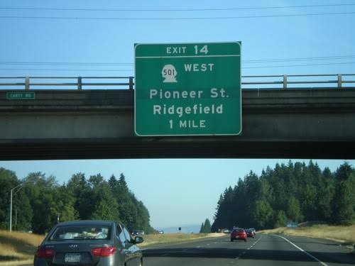
If you have ever sat on Pioneer Street at 5:15 on a weekday and wondered whether anyone in charge has noticed, good news: they have. Since 2007, actually. The City of Ridgefield and Clark County are working on a new road that would connect the south end of town, around NW Hillhurst Road and NW 31st Avenue, to the existing I-5 interchange at NE 219th Street (SR 502), better known as the Battle Ground exit.
It's called the I-5 South Connector Study, and it's now in Stage II. That's the part where a long list of possible routes gets whittled down to one, and the city wants to hear from the people who will actually drive it. The first of two open houses is Thursday, November 12, at the TMI Building downtown. If you can't make it in person, the same materials and feedback forms go live online that day and stay up through December 4.
Open House at a Glance
Why this keeps coming up
Right now, Pioneer Street is the city's only direct on-ramp to I-5. Everyone south of downtown who wants the freeway either funnels onto Pioneer or wanders the back roads down to the 179th Street exit. And 179th already has its hands full with the fairgrounds, the amphitheater, and a west-side emergency services station shared by Clark County Fire District 6 and Clark-Cowlitz Fire Rescue.
Meanwhile, the 219th Street interchange has been sitting just south of town since WSDOT built it in 2008. According to the project's own Q&A, it was designed to accommodate a future connection to the west. That connection just never got built, because the local roads it would tie into didn't exist on the county's maps yet.
The city's stated goals are pretty straightforward: take pressure off the Pioneer, SR 502, and 179th interchanges, give emergency responders a faster and safer route, and plan for the growth that is very obviously already here. Look around. New neighborhoods, new businesses, new fire stations. The roads have some catching up to do.
Seven routes, one winner (eventually)
Stage I wrapped in 2021 with a corridor study that produced seven possible alignments, color-coded on the project map. Stage II takes the most promising of those and digs in: refining them, running environmental analysis, and comparing each one against a no-build option, meaning "leave everything as it is." The project team has also said combinations of routes are on the table, so the final answer may not look exactly like any single line on the map.
Whatever comes out the other end is called the Preliminary Locally Preferred Alternative, or PLPA. Catchy, right? It will be chosen based on three things: the alternatives evaluation, additional environmental studies, and public feedback. That last one is you.
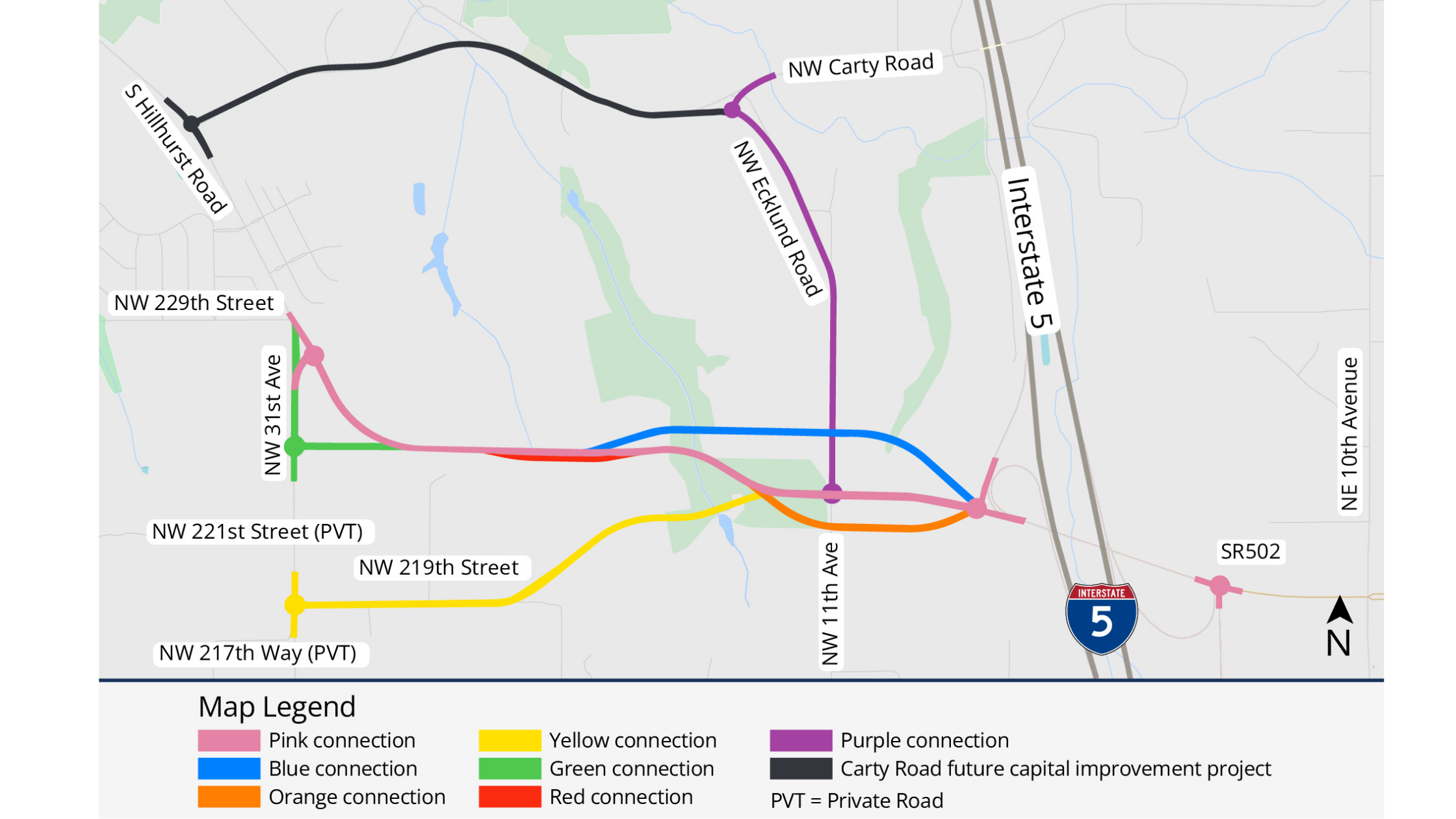
For context on what kind of road we're talking about: this isn't a new freeway. Per the project FAQ, the plan is a two-lane road with paved shoulders, classified by the county as a rural major collector. The stretch inside city limits would also get bike lanes and sidewalks. It would plug into the existing 219th Street ramps, not create a new interchange.
Okay, but when?
Let's be honest about the timeline, because nobody should walk away from this thinking there will be pavement by next summer.
In 2025, the city received $268,758 from the Washington State Department of Transportation and the Federal Highway Administration. That money pays for the current planning study and nothing else. The project's own timeline puts 2026 as the year to analyze the alternatives, pick a preferred route, and complete a Level 1 environmental study. Design and construction are listed as 2027 and beyond, and only once the city secures additional funding, which it has not yet done.
For a sense of scale, a 2023 presentation to a joint meeting of the Ridgefield City Council and Clark County Council estimated the south connection at roughly $40 to $45 million. That's a planning-stage number from three years ago, so treat it as a ballpark, not a price tag. The final pick is expected to be a joint decision by both councils.
So: long road (sorry). But this is the stage where the route actually gets chosen. Once a line is on the map and the money shows up, it's a lot harder to move.
Frequently asked questions
Is this a new freeway exit?
No. The new road would connect to the interchange that already exists at NE 219th Street / SR 502. The project FAQ says it would most likely link into the existing northbound and southbound ramps there.
Why not just put an interchange at Carty Road?
This comes up every time. According to the project FAQ, the Federal Highway Administration controls I-5 access and generally requires about three miles between interchanges in a rural area like this one. A Carty Road interchange wouldn't meet that standard, so it isn't part of this study.
Will this pull business away from Pioneer Street?
The city says that's not the goal. The idea is to give drivers a second option and ease the congestion expected on Pioneer as the town grows. That would arguably make downtown easier to reach, not harder.
Does this open up new land for development?
Per the FAQ, the project doesn't propose any land use or zoning changes. Sewer and similar utilities can't be extended outside the urban growth boundary as part of it either.
What if one of the routes crosses my property?
The city says it prefers not to split private parcels but can't always avoid it because of environmental constraints. Specific property impacts get worked out during design, after a route is chosen and funded. The FAQ says owners will be contacted directly and compensated through the eminent domain process. If you live in the study area, this open house is your best chance to see exactly where each line falls.
I can't make it on November 12. Does my feedback still count?
Yes. The full open house content and feedback opportunities go live on the project page on November 12 and stay open through December 4. The page also has a Q&A tool, a survey, and a map you can comment on directly.
More from Meanwhile in Ridgefield
Everybody in this town has an opinion about Pioneer Street traffic. Here's your chance to put it somewhere useful. Swing by the TMI Building on November 12, grab a coffee on Main on your way, and tell the folks at the map table what you actually think. If you go, let us know what you heard. We'll keep following this one.
